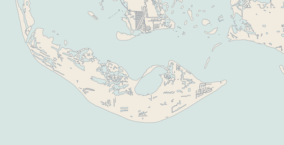
An island that became a city in order to control its own building, with a federal wildlife refuge over a large share of it. The counter-argument to everything fast-growing on the mainland.
The beach at Wulfert, looking toward Captiva, 2008. Photo · Bradeos Graphon · Public domain
Sanibel at a glance
1974
incorporated as a city to control its own building
−1.3%
population change, 2020 to 1 July 2025 — the only one of the five that fell
$6.00
causeway toll with a transponder, charged only on the way out
8+
of the island’s 18 square miles are wildlife refuge
0
traffic lights on the island
1884
the lighthouse was first lit, in August
What is Sanibel like?
Sanibel decided this deliberately: the city incorporated in 1974 to control its own land use, and the result is no traffic lights, low density, shared-use paths, and the J.N. “Ding” Darling National Wildlife Refuge across a large share of the island.
It is the quietest of the five and the least convenient. It is reached only by a toll causeway, and groceries and contractors are an island problem rather than an errand.
It is also a genuinely different market from the mainland, with different rules and different risk. Sanibel lost its causeway in a hurricane in 2022; an island that loses its road does not grow like the mainland.
Sanibel voted against high-rises. That is the counter-argument to everything fast-growing on the mainland.
The rules came first
A city that exists to limit what gets built on it
An island that became a city in order to control its own building, with a federal wildlife refuge over a large share of it. The city sets the minimum stay under a land-use plan it adopted to control its own density — and the trap is reading the island as one rule instead of several districts.
Lee County charges the causeway toll only on the trip out to the island; the return to Fort Myers is free. LeeWay sells discount passes, including an unlimited annual Sanibel pass.
An island that loses its road does not grow like the mainland, and we are not averaging it in.
No traffic lights, low density, shared-use paths
School District of Lee County — countywide district
Live shells are protected, and the penalty is a fine and jail time
The long horizon
How Sanibel stayed Sanibel
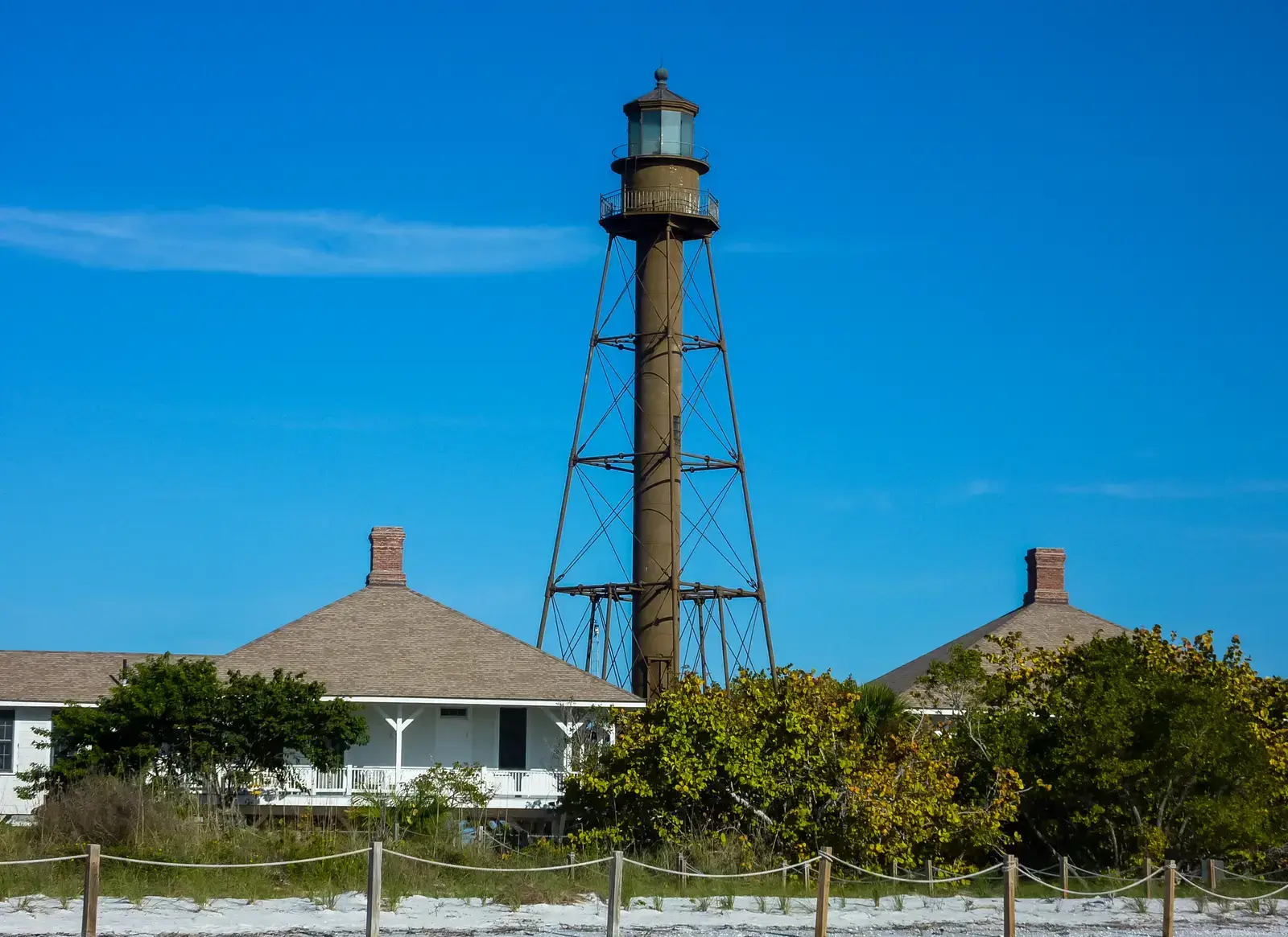
The Point Ybel lighthouse, 2012.1884
The lighthouse is lit
The Point Ybel light “was first lit on August 20, 1884”, according to its National Register nomination. Congress had funded it three years earlier; the schooner carrying its iron frame wrecked two miles off the island. It is still Sanibel’s emblem, and after Hurricane Ian it was repaired with a replacement leg.
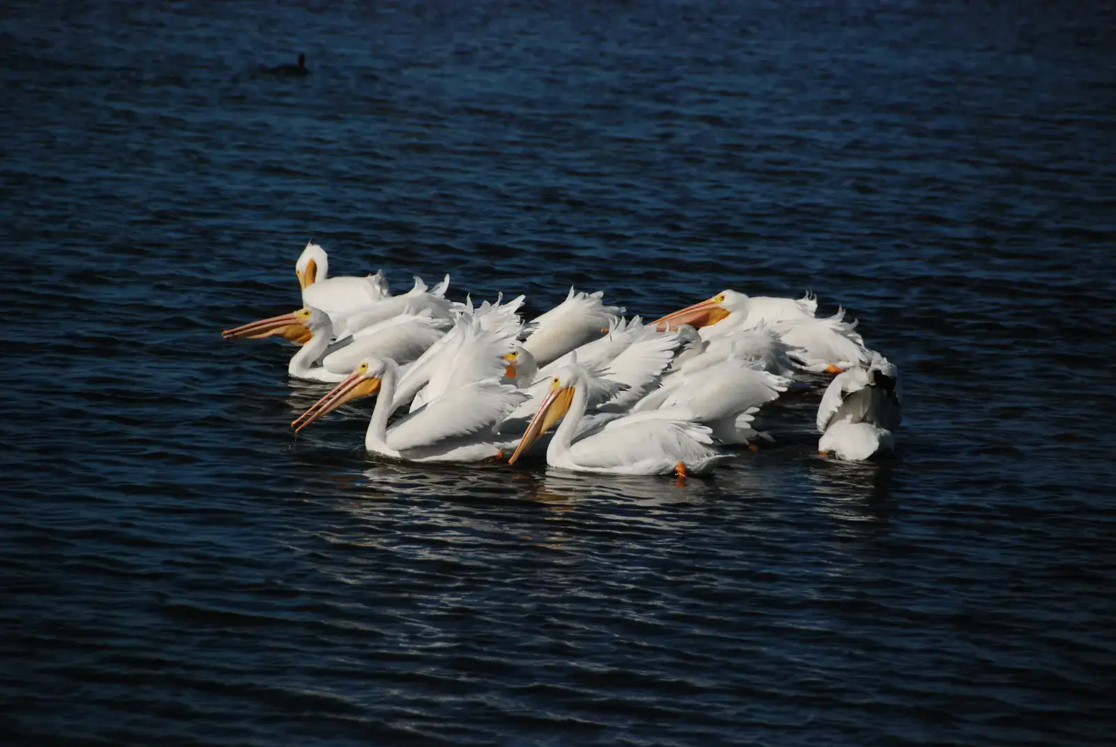
White pelicans in the refuge. U.S. Fish and Wildlife Service.1945
A federal refuge, by lease
The Sanibel National Wildlife Refuge was established on 1 December 1945 — not by executive order, as is often repeated, but “by agreement through a lease” with the State of Florida under the Migratory Bird Conservation Act, over 2,392 acres. Federal protection reached this island decades before most of Florida’s coast was built over.
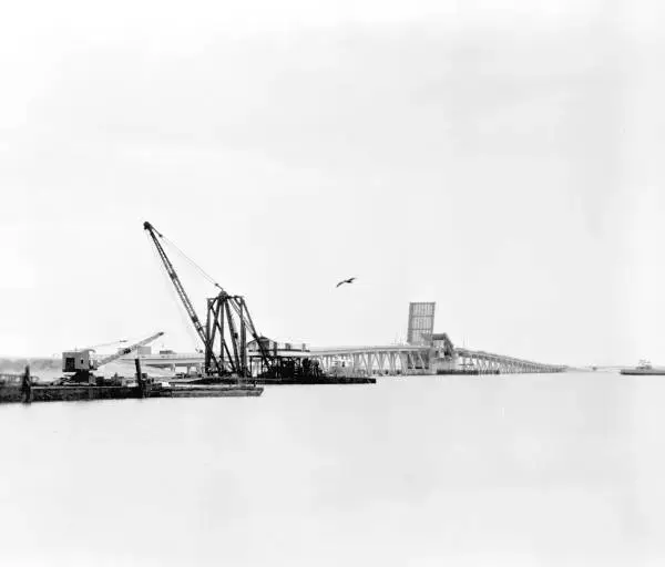
The causeway’s drawbridge under construction, 1963.1963
The causeway replaces the ferry
Lee County records that the original causeway and drawbridge “opened to traffic in 1963, replacing a ferry” that had run from Punta Rassa since 1912. A road turned the argument about the island’s future from theoretical into urgent. Today’s bridges opened in 2007.
“Ding” Darling at his drawing board. U.S. National Archives.1967
Renamed for “Ding” Darling
The refuge was renamed in 1967 for Jay Norwood “Ding” Darling, the Des Moines Register’s two-time Pulitzer-winning cartoonist, made head of the U.S. Biological Survey in 1934, who remade the agency in twenty months. The Fish and Wildlife Service credits him with a decisive role in stopping the sale of Sanibel’s environmentally valuable land to developers.
1974
1974
Sanibel incorporates, on purpose
“In December of 1974, Sanibel Island incorporated as a municipality in Lee County, Florida”: the city’s own words. The reason is put just as plainly in the plan: county zoning “would have allowed some 30,000 residential units on Sanibel, with practically no environmental safeguards”. Residents voted that November and were a city that December.
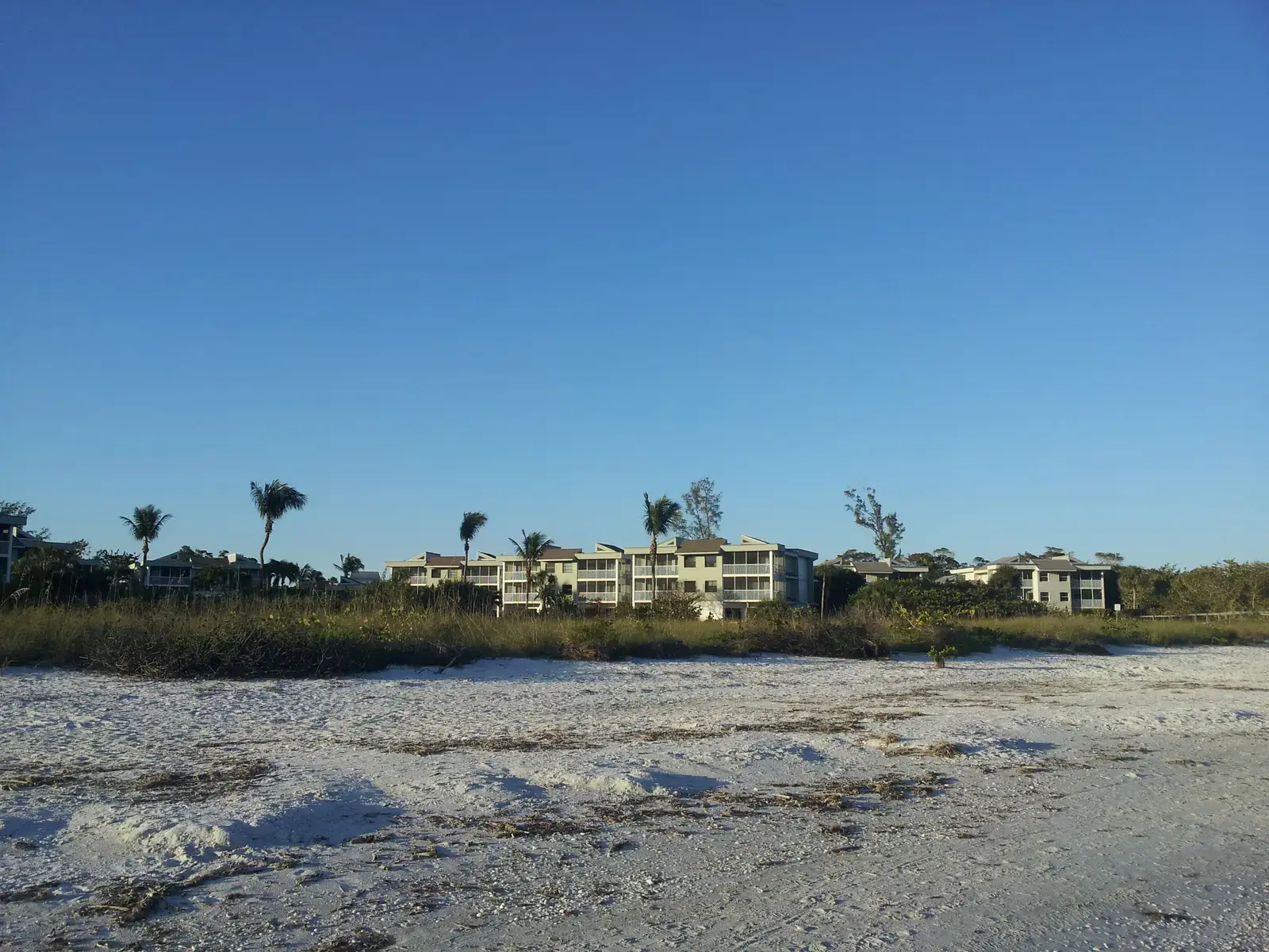
Building kept low and back from the beach, Sanibel.1976
The plan that set the ceiling
The Sanibel Plan was adopted on 19 July 1976 by Ordinance 76-21. It set out to cut the housing units allowed on the island to about 7,800; the figure rose to about 9,000 by 1989 and, in the city’s own words, “since 1989 there has been no increase in permitted dwelling units”. That sentence is the whole island in one line.
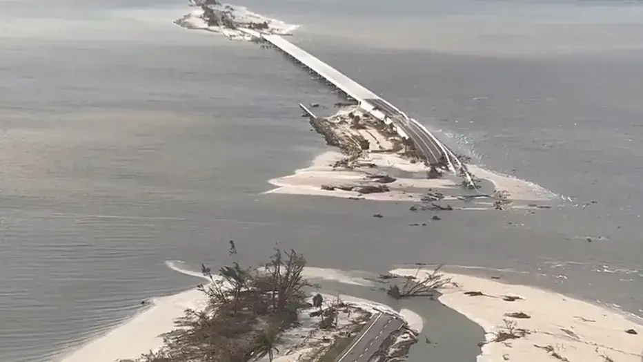
The causeway the day after Ian, 29 September 2022. Lee County Sheriff’s Office.2022
Hurricane Ian
Hurricane Ian made landfall at Cayo Costa on 28 September 2022 as a category 4. Sanibel took the eyewall: the National Hurricane Center recorded 9 to 13 feet of inundation above ground on the east end, a USGS sensor measured 12.58 feet above mean higher high water, and USGS crews logged high-water marks of 6 to 9 feet above ground across the island. “Portions of the Sanibel Causeway were washed out by the surge”, the report says, and the island was cut off. The Florida Department of Transportation restored access for residents on 19 October 2022, twenty-one days after landfall; the causeway was reported substantially complete, all lanes open, in December 2023.
Who does Sanibel suit?
The quietest of the five, and the hardest to get on and off. Both halves of that sentence are the point.
01Quiet over convenient
Sanibel decided this deliberately: the city incorporated to control its own land use, and the result is no traffic lights, low density, shared-use paths, and the “Ding” Darling refuge across a large share of the island. The trade-off: it is reached by causeway and by toll, groceries and contractors are an island problem rather than an errand, and it is a genuinely different market from the mainland with different rules and different risk.
02Just visiting
Want shells and birds and no traffic lights: Sanibel. Live shells are protected, and the penalty is a fine and jail time — which is the kind of thing worth knowing before you fill a bucket.
03A snowbird
Sanibel is the quietest and the hardest to get on and off. If what you want out of five months is to be left alone, that is a feature; if you want to walk to dinner, Naples and Sarasota are the walkable options.
What do you do on Sanibel?
Shells, birds and a bicycle. The refuge covers a large share of the island, and the shared-use paths are the way people actually get around. Hours below were checked against each place’s own posting on 1 September 2026, and the last three on 2 October — and on Sanibel that date matters more than usual, because half of this list is still in Ian recovery.
A four-mile one-way road through the refuge that covers more than eight of the island’s eighteen square miles. $1 rather than $10 if you walk it or ride it. The gate times changed to 7-to-7 on 1 September; Friday is a full closure, holidays included.
CLOSED since 27 July 2026 · reopening projected 1 October
Shut for construction tied to Hurricane Ian recovery, along with the Nature Store and the main parking lot. Wildlife Drive is open throughout. Three trails are also closed: Calusa Shell Mound, Mangrove Overlook, and Indigo between the centre and the fee booth.
The refuge’s freshwater parcel off Tarpon Bay Road, and the part of it that stayed open through all of this. It is not on the closed-on-Friday list, which makes it the answer on the one day the Drive is shut.
More than six miles of trails by SCCF’s own count on its trails page. The William and Ruth Brooks trails are only half a mile open — hurricane restoration is still underway there.
The east end, where the Gulf meets San Carlos Bay, under a lighthouse first lit in August 1884. The lighthouse is not open for tours and the fishing pier is currently closed. Parking is by mobile payment — the pay stations did not survive Ian.
The shelling beach, and the least developed of the seven. 222 spaces, a kayak launch, and a walk over a bridge from the car park — which is the reason it stays quieter than the rest.
Mon–Sat 10 a.m. – 5 p.m. · closed Sundays until 1 November
An accredited museum and aquarium, not a gift shop with a case of shells — and the reason you will start being able to name what you pick up. Gallery talks run daily at 11, 2 and 3. Closed Thanksgiving, Christmas Eve, Christmas Day and New Year’s Day.
The refuge’s concessionaire on Tarpon Bay Road: kayak and paddleboard rentals and guided nature tours. Paddling Tarpon Bay is the version of this island most people remember.
CLOSED since 27 April 2026 · tours resume 15 October
Historic island buildings moved to one site on Dunlop Road, and the place to see what Sanibel was before the causeway. Its own notice puts the seasonal closure from 27 April to 15 October 2026.
We do not host on Sanibel. Stephanie works with buyers here as part of one corridor, Sarasota down to Naples, and she represents the person buying — which on this island means reading the district rules and the association documents before anyone falls for a photograph.
Yes. Hurricane Ian severed the Sanibel Causeway on 28 September 2022 and cut the island off; the Florida Department of Transportation restored access for residents on 19 October 2022, and causeway restoration was reported substantially complete with all lanes open in December 2023. The island is open, visited, and in places still restoring: the refuge’s Visitor & Education Center is closed for construction from 27 July to 1 October 2026, the Lighthouse Beach Park fishing pier is closed, and some SCCF trails are only partly open.
How much is the toll to drive to Sanibel?
$6.00 for a two-axle vehicle with a transponder and a prepaid LeeWay account, or $6.00 plus a $3 administrative fee if you pay by plate. Lee County charges the toll only on the trip out to the island — all three lanes at the toll plaza run westward toward Sanibel — so returning to Fort Myers is free. The county went all-electronic in October 2021, so there are no cash booths. LeeWay also sells discount programs, including an unlimited annual Sanibel pass. Rates checked 10 August 2026.
Can you take shells from Sanibel beaches?
Empty shells, yes. Live ones, no. The City of Sanibel states that the applicable rule “prohibits the harvest and possession of live shellfish”, and that violators face a $500 fine and 60 days in jail for a first offense. All shelling is prohibited within the waters of the J.N. “Ding” Darling National Wildlife Refuge. Sand dollars, sea stars and sea urchins are protected as well. The rule is a Florida Fish and Wildlife Conservation Commission rule and has applied across Lee County since 1 March 2002.
Why are there no traffic lights or high-rises on Sanibel?
Because the island incorporated as a city in December 1974 specifically to control its own land use, and wrote both rules into the plan it adopted on 19 July 1976. The Sanibel Plan states that “conventional traffic control techniques such as traffic signals are not desired on the island” and that they should not be installed even where signal warrants are met — and the City charter requires a public vote to add one on any of the main roads. On height, the plan states that “the height of buildings will not exceed three stories above the base flood elevation”. Both have documented exceptions, so “no high-rises” is accurate while “no exceptions” is not.
How much of Sanibel is the wildlife refuge?
Roughly half. The U.S. Fish and Wildlife Service’s conservation plan describes the J.N. “Ding” Darling National Wildlife Refuge as “comprising roughly half of Sanibel Island and most of Buck Key”. The refuge covers more than 6,400 acres of mangrove forest, submerged seagrass beds and other habitat, about 2,620 acres of which Congress has designated a Federal Wilderness Area.
Can you rent out a house on Sanibel short-term?
Short stays on Sanibel are regulated by the City’s land development code, and the rule is strict. The City states that most homes on the island may only be rented for a minimum of four consecutive weeks, and that renting at all requires a rental dwelling licence and a business tax receipt. The exception is property where resort housing is a permitted use, which has no minimum. The code section is 126-1076, and a violation is a second-degree misdemeanour carrying up to $500 a day per unit. Whether any particular address falls under the exception is the question, and it is not one you can answer from a listing. Get the rule for the specific property in writing from the City of Sanibel planning department before you make an offer.
Does Sunshine Endeavors have a rental on Sanibel?
No. Sunshine Endeavors owns and manages three homes — two in Cape Coral and a condo on Fort Myers Beach — and none of them is on Sanibel. The Fort Myers Beach Condo is the nearest, roughly 40 minutes away over the causeway. Stephanie DeLisle does work as a buyer’s agent on Sanibel, so if buying here is the question, that part of the connection is real.
Photographs and sources
Hero · The beach at Wulfert, looking toward Captiva, 2008. Bradeos Graphon · Public domain · source
Figures are the most recent each source publishes. Flood zones, bridges and insurance are address by address — ask us about the one you are looking at.